Will Google’s new augmented reality maps save us from ever getting lost again?

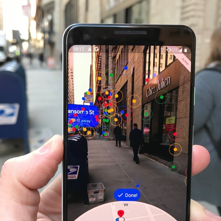
- Test of its unreleased pedestrian maps technology shows on-screen arrows and warning signs along the chosen route. So does it work, asks Nick Bastone?
Anyone visiting a new city knows the confusion of emerging from a subway station and trying to figure out in which direction to turn.
Even with your maps app open, orienting yourself in an unfamiliar place can be difficult and lead to some missteps.
However, Google believes it has solved the problem using augmented reality (AR) technology.
Last week the Google Maps team gave Business Insider the chance to try out its new AR feature for pedestrian maps, which the company first teased at its developer conference last May.
The team says the feature is in an “alpha” state and for now, will be available only to “local guides” – Google Maps enthusiasts who provide useful product feedback.
Even without a definite public release date, we were anxious to see if AR could actually improve the Google Maps experience.
Check out what it was like to use the new Google Maps AR feature on the streets of San Francisco, in the United States.
We met members of the Google Maps team at Rincon Park, which is right near the San Francisco-Oakland Bay Bridge.
We decided we could all use some caffeine, so to test out the new AR feature, we headed to Blue Bottle Coffee in Sansome Street.
We put the destination into Google Maps to begin the journey.


