Advertisement
Pakistan’s Karakoram Highway – ups and downs of a trip on ‘8th wonder of the world’: stunning views, welcoming people, but landslides, altitude sickness are hazards
- The 1,300km-long road connects China and Pakistan via the heavenly Hunza Valley, where women’s rights are protected and literacy is high – as is nearby peak K2
- Dizzying scenery abounds, but, as the road’s name – meaning ‘crumbling rock’ – suggests, landslides are common. Then there’s Pakistan’s political instability
Reading Time:4 minutes
Why you can trust SCMP
3
Often portrayed in the media as a politically volatile nuclear power, Pakistan is home to some of the most genuinely hospitable people on Earth.
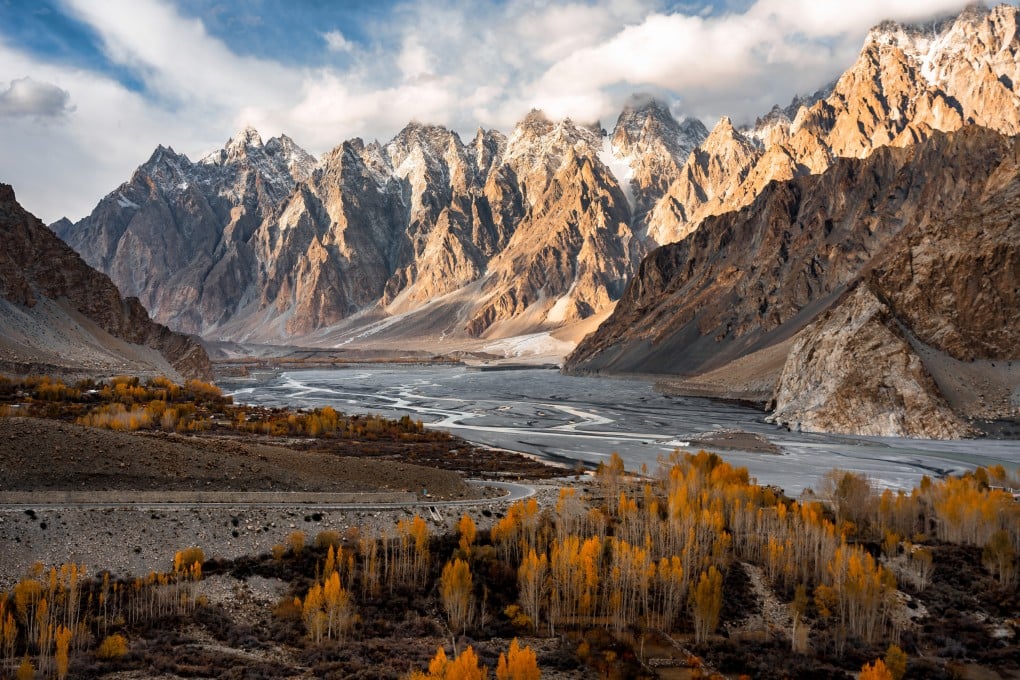
It’s a country of parched, dusty landscapes that give way to a beautiful land of snow-capped mountains, massive glaciers and azure lakes that few outsiders could find on a map.
From the capital, Islamabad, there are two ways to reach the Hunza Valley. Flying to the city of Gilgit, then switching to a bus or taxi, will have you there in about four hours. An infinitely more rewarding alternative is to travel the length of the 1,300km (810-mile) Karakoram Highway (KKH), a spur of the ancient Silk Road traversed by traders for centuries.
The KKH is best experienced in spring or autumn, when the weather is obliging and visibility is excellent.

A Sino-Pakistan joint venture, the road was blasted out of mountains where in many places only donkey tracks had existed. Dubbed the eighth wonder of the world, the engineering marvel is known as the Friendship Highway in China.
Construction began in 1959 and the international artery opened to the public in 1979. The route wriggles through three of the world’s highest, most magnificent mountain ranges: the Himalayas, the Hindu Kush and the Karakoram, which gives the highway its name.
Advertisement