Advertisement

How European maps of China helped paint a picture of the Middle Kingdom during the age of exploration

  • 127 European maps of China made during the Ming and Qing dynasties feature in a book which shows how the Middle Kingdom was seen in the West, and by itself
Reading Time:12 minutes
Why you can trust SCMP
2
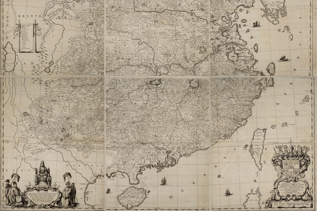
The map of the whole of China from Martino Martini’s Novus Atlas Sinensis, published in Amsterdam in 1655. A new compilation of 127 maps of China produced between 1584 and 1735 shows how mapmakers helped paint a – somewhat – accurate picture of China during this period.

The Kangxi emperor is unhappy.

Advertisement

By 1686 the second Qing monarch to rule from Beijing had largely completed the pacification of Ming territory, and was following earlier rulers in defining his newly established domain on paper. For foreign conquerors, this making of maps is particularly important.

To ensure the stability of their minority rule, the Manchu invaders adopted the traditions of the Chinese Confucian bureaucracy, at least in public, and supported the view that everything of importance was part of their empire. Anything else was minor, barbarian, peripheral and supplicant.

Little was known of the rest of the world, and if it appeared on maps it was drawn very small. Kangxi was thus not so much asserting ownership of limited territory, as taking a census of everything that mattered.
A 19th century edition of the Complete Geographical Map of the Great Qing Dynasty produced by a Chinese cartographer in 1767 during the Qing dynasty. Until the reign of the second Qing emperor, Kangxi, provincial Chinese maps were drawn to different standards and thus were impossible to compile to create a whole picture of China. Photo: HKUST

Much of the information needed had already been gathered. From as early as the 6th and 7th centuries Sui dynasty central governments had instructed local authorities to produce gazetteers, although in some areas these had been produced for centuries even before that.

Advertisement

They show the distances between key towns, and contain assorted information on the local economy, natural history, culture and famous personages.

Advertisement