Old maps of China shed light on modern border disputes and how it sees the world today at Hong Kong exhibition
- A show of 80 historic maps and charts reveal China’s view of itself over the centuries and give clues on why the country now conducts business as it does
- The exhibition at the Hong Kong Maritime Museum also shows that the West’s view of China was long distorted
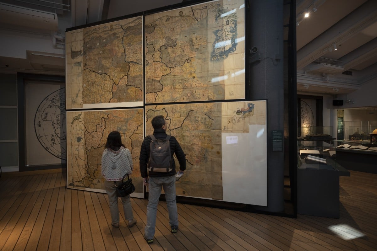
Towering at a height of four metres, the Huang-Ming Yitong Da Tu, a magnificent old map of China, was hand-copied from an original produced by Japanese monks in Nagasaki in 1771.
The map, whose title translates as the Unified Atlas of the August Ming, is one of 80 historic maps and nautical charts on display at the Hong Kong Maritime Museum as part of an exhibition called “The World on Paper: From Square to Sphericity”.
“Maps both reflect history and are a record of history,” says collector Tam Kwong-lim, who helped curate the exhibition.
Running until February 24, the exhibition not only follows the evolution of Chinese navigation and cartography, but reveals how China saw itself in the world and how the rest of the world perceived China.

Tam bought his first old map of China in a second-hand bookshop in Tokyo while working in the city as a shipping executive in the 1970s. He has since been an avid collector and is now recognised as an authority on antique maps and charts, which, he points out, still influence modern geopolitical and territorial disputes.
